http://www.forestpal.com/images/su_isoline_map.gif
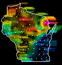
An isoline map uses lines to show different values and those lines may also be different colors to show different values as well. This map shows the different temperatures around this state. The red areas are areas of warmer weather, and the blue are areas of colder weather.
No comments:
Post a Comment