http://upload.wikimedia.org/wikipedia/commons/thumb/d/d8/Hawaii_Island_topographic_map-fr.svg/728px-Hawaii_Island_topographic_map-fr.svg.png
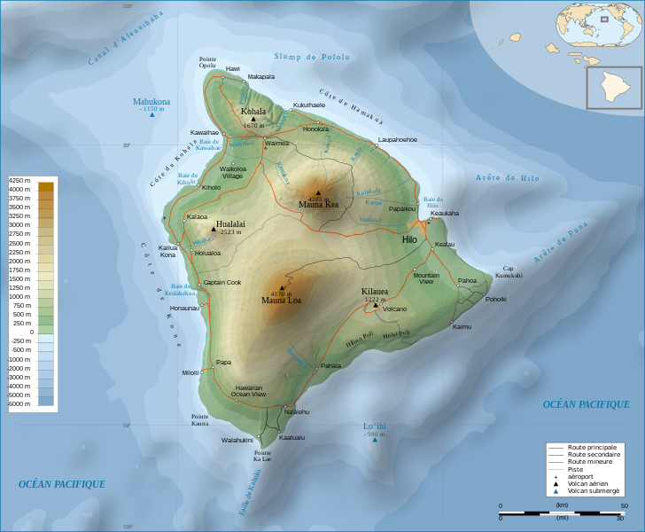
A topographic map is one that shows detail and relief by using contour lines to represent different heights above or below sea level. This topographic map shows that this Hawaiian island has two peaks at heights between 4100 and 4200. Also it shows that the area surrounding the island is higher than the ocean floor.
No comments:
Post a Comment